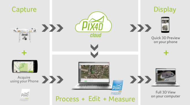
If you want to create a 3D model of your property, or need to inspect a roof for house extension or solar installation, this might be the product for you. The Pix4Dmapper Mesh Will automatically convert images or video taken from your drone and produce a three dimensional model of that area. First you can create a flight plan to capture the images using a free mobile application called Pix4dmapper Capture App. Then take your drone and fly over the property to take a video or photographs of that area. Then use the desktop software to edit and optimize the project into a 3D layout that allows you to create a fly through video or export the model in full 3D textured mesh. This same program can be creatively used to map your adventure and create a 3-D video animation.