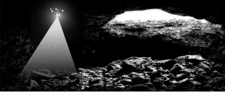
“Small free-flying spacecraft might be the ideal robotic platform for the exploration of lava tubes on Earth, the Moon, and Mars for the simple reason that they would not need to come in direct contact with any of the rough and potentially unstable surfaces found inside caves and lava tubes,” says Andrew Horchler, Director of Future Missions and Technology at Astrobotic, the private space company developing the drone-based LiDAR mapping technology. “Nimble drones could enter, map, and exit caves quickly, returning from the darkness to send data back to Earth, return a sample to the surface, recharge and refuel.”
While a cave-exploring drone on Earth may use propellers, free-flying spacecraft exploring caves on the Moon, where there is practically no atmosphere, or in the thin air of high altitude lava tubes on Mars’ giant volcanoes, would have to use small thrusters. The mission of the terrestrial drone deployed at the Lofthellir Ice Cave focused on validating the idea of using a drone-equipped LiDAR to safely navigate and accurately map rock and ice inside a dark lava tube in the absence of GPS or any prior map.
Under a research contract with NASA, Astrobotic has developed a custom navigation software product, known as AstroNav, to give drones and small free-flying spacecraft the ability to autonomously explore and map subterranean environments. AstroNav employs both stereo vision and LiDAR, works without GPS or previously stored maps, and can operate in real-time while a novel environment is explored at a high rate of speed.
For the full story from Seti.org, click here.