A new industrial revolution is underway, and drones are a major catalyst. These airborne machines are being embraced by industries ranging from agriculture to energy and even insurance. In some instances, the capabilities afforded by drones are forcing companies to completely rethink the ways they do business.
The current widespread employment of commercial drones was difficult to foresee even just a few years ago. But as the technology and maturity of small unmanned aircraft rapidly evolved, so did the variety of useful payloads they could carry. Equally important are developments in the software tools that are used to manage and interpret drone-derived data. This killer combination of reliable aircraft, precise sensors, and meaningful data output is the key that has unlocked the door for drones to enter numerous industries. Let’s take a look at some of the elements that are making drones the new tool of choice for many jobs.
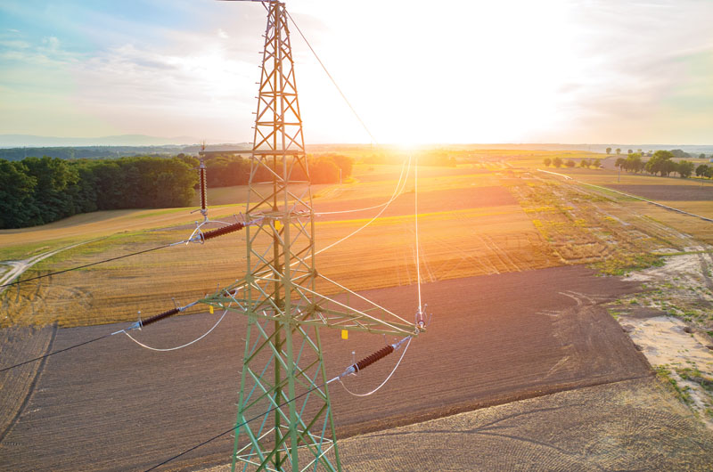
The DJI Z30 zoom camera allows drone-flying power-line inspectors to get detailed photographs without flying dangerously close to the towers. (Photo courtesy of DaVinci)
Seeing Is Believing
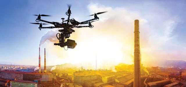
In most cases, the job of a commercial drone is to focus a camera on something that is too difficult, dangerous, or expensive to see by other means. Why send an inspector to the top of a high-voltage transmission line when a drone can do the job at far less risk? Inspecting dangerous devices such as microwave towers and flare stacks means shutting things down while humans are close by, and this mandatory safety step could cost a company many thousands of dollars in lost production. Yet a drone with the right equipment can fly into the danger zone to get a close look without the costly downtime.
The cameras being carried by drones to do such jobs seldom represent cutting-edge imaging technology. After all, analysts and scientists have used specialized cameras attached to full-scale aircraft for years. The real innovation lies in how these legacy cameras have been downsized and adapted for use on drones.
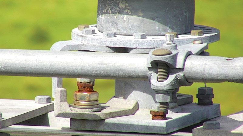
One example of a drone-specific camera development is DJI’s Zenmuse Z30. Most small aerial cameras have a fixed wide-angle lens. Getting a shot with sufficient details to inspect something like a suspect bolt could mean flying uncomfortably close to the subject, so the advantage of the Z30 is that it offers up to 30X optical and 6X digital zoom. This permits pilots to maintain a significant buffer while getting tight, precise shots.
The Z30 is not the only zoom option for drone pilots. Traditional DSLR and other zoom-lens cameras designed for handheld use can be fitted to a drone and hauled aloft. And there are times when a DSLR is still the best choice. The Z30, however, offers a zoom solution that was designed specifically for integration with drones. Waylon Johnson, cofounder and chief pilot of DaVinci Commercial Drone Service, believes that the Z30 provides several advantages over DSLR rigs. He says, “It’s very lightweight by comparison, especially when you consider the various types of gimbals that need to be incorporated for DSLR cameras. The Z30 incorporates itself nicely into DJI’s photocentric flight modes, such as Spotlight and Tripod. It has a nice tap-to-zoom feature [TapZoom] as well.”
Although Johnson is a big fan of the Z30, he is quick to point out that it and other zoom lens–equipped cameras are not magic bullets. There are times when zoom capabilities are irrelevant and poor lighting conditions become the dominant factor. Tactical weapon lights attached to the drone can illuminate components that are obscured by shadows. But these lights are effective only at relatively close range, forcing the pilots to fly near the subject to get the shot.
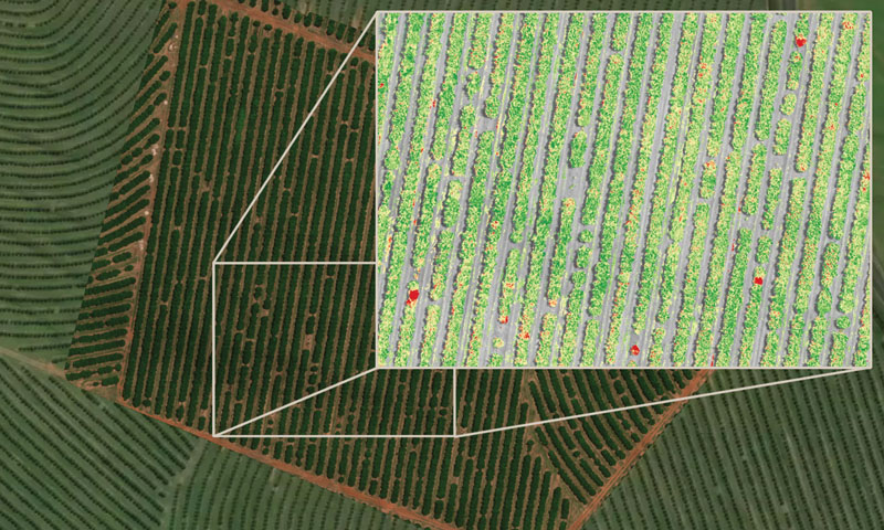
This image of a citrus orchard illustrates how a multispectral image (inset) can reveal data that is unseen in a standard photo (background). The red spots indicate phytophthora, a destructive microorganism. (Photo courtesy of 3D-GEO)
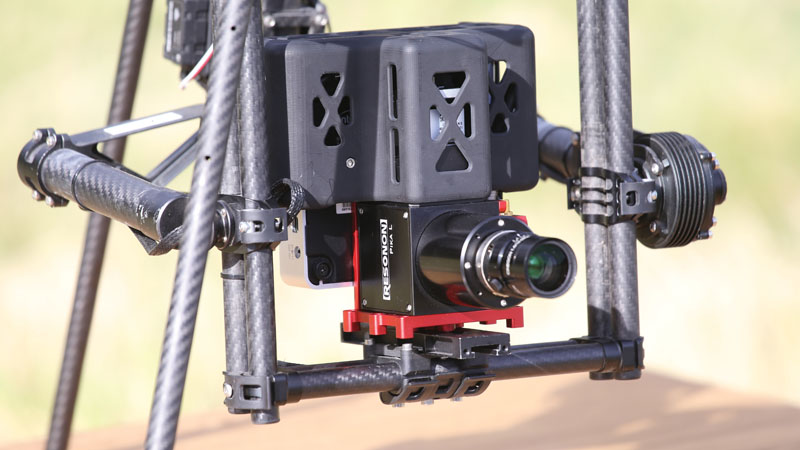
Although hyperspectral cameras have been around for many years, they have only recently been adapted for use on commercial drones. This Resonon Pika L weighs just
1.3 pounds and captures 281 color channels. (Photo courtesy of Resonon)
The Nth Degree
Hyperspectral imaging is similar in concept to multispectral imaging, but there are two fundamental differences. First, the color bands in a hyperspectral image are much narrower. This allows users of hyperspectral cameras to hone in on the precise wavelengths that are most informative for their application. Second, there are no gaps in color coverage with hyperspectral images. While a multispectral imager might capture five bands of color and ignore the rest of the spectrum, a hyperspectral imager captures the entire spectrum using hundreds of color bands. The Resonon Pika L aerial hyperspectral camera, for example, has 281 color bands (channels).
Analysts reviewing hyperspectral images can view any individual or combination of color bands that they deem relevant. The breadth and precision of the available colors paint a clearer picture for those who interpret those colors as meaningful data. Inspectors at oil refineries, for instance, can use hyperspectral sensors to see dangerous methane gas leaks—even very small ones.
Such high-resolution imaging does not come without a cost. Hyperspectral sensors generate mountains of data. That data must be processed, analyzed, and stored even if only a few of the channels contain pertinent data for a given task. Scott Conley, Resonon’s senior scientist, states that creating hyperspectral imagers for the drone industry required innovation on two fronts. First, the actual cameras had to be downsized and lightened into a reasonable payload (the Pika L weighs a mere 1.3 pounds). The second and equally important necessity was the advent of affordable computers with sufficient processing power to manage hyperspectral data. Conley adds, “You don’t need a room full of computers anymore.”
In spite of the significant overhead in data storage and processing, more companies are choosing the hyperspectral option. According to Thomas Haun, executive vice president at PrecisionHawk, a drone service company that offers both multispectral- and hyperspectral-imaging packages, “What we’re actually feeling more and more pull for, and where we try to spend most of our time, is the advanced sensors, including hyperspectral. That’s super interesting to us because it unlocks a whole new set of solutions. Integrating those sensors into drones isn’t done widely today. So we’ve been taking the time to [answer the question] ‘What is the best way to use those sensors and generate solutions?'”
The full scope of potential applications for drone-based hyperspectral cameras is still uncertain. Consequently, many businesses are reluctant to discard hyperspectral data they don’t necessarily need. Haun explains, “I don’t know that here has been enough application development done for hyperspectral imaging to say, ‘When you’re using it for purpose ABC, you only need to collect this set of data and you don’t need to worry about the rest.’ Because it is so early in this type of sensor development and data analysis, companies don’t want to get rid of the data. We might not have an application for it today. But once it is captured, I can always come back to it. And I might have an application for it tomorrow. The plus is that there are a lot of macro factors making data storage incredibly inexpensive.”
Drones are being utilized in the insurance industry to automate and expedite roof inspections. (Photo courtesy of Kespry)
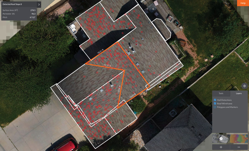
Beware insurance fraudsters! Developers have created artificial-intelligence capabilities for drone-based roof inspection that detects fake hail damage. (Photo courtesy of Kespry)
The Old-Fashioned Way
Many flight-related tasks can be programmed and executed autonomously. Yet the monotonous drudgery of analyzing the resulting images is still primarily delegated to humans. In the energy sector, subject-matter experts must examine countless high-definition images, looking for problems. The evidence could be as obvious as an occupied bird nest or as subtle as a missing cotter pin.
Analytical tasks can be a significant portion of labor costs. All too frequently, they are also a bottleneck in the overall workflow. There is currently a big push in the commercial-drone community to apply machine-learning algorithms in an effort to automate photo analysis.
The insurance industry is also taking a keen interest in developing Artificial Intelligence (AI) for analyzing drone-derived data. One of the primary tasks for insurance drones is inspecting roofs for damage. As with other industries, there is a particular benefit to getting the data processed rapidly. Insurance claims that are paid quickly create happy customers.
The Kespry drone is used by several insurance companies for roof inspections. Kespry’s David Shearer says that the company is working on AI capabilities for its drones, and customer satisfaction is not the insurance companies’ only incentive for wanting it. He notes, “One of the things that we’ve been helping insurance companies with is to automatically recognize what is a naturally occurring hail pattern by Mother Nature and what is an unnatural pattern by some guy with a hammer. We can detect fraud very, very quickly. We have over 90 percent accuracy on that already.”