It’s perfectly clear — rotordrones and multirotor craft are here to stay. Turn on the TV and in no time you’ll see news mentions discussing the pros and cons of this still- evolving technology. Rotordrones and various other multirotor designs are a curiosity for most folks and too often are shown in a negative light. In the business of selling newspapers and improving TV ratings, good news just doesn’t sell as well as bad news. In reality, there’s lots of good stuff to talk about where drones are concerned.
 Above: Dr. Jason Box launches his 3DR Isis off the Greenland ice sheet. The white card is to reset the on-board camera’s white balance for accurate spectrographic photos.
Combating Global Warming
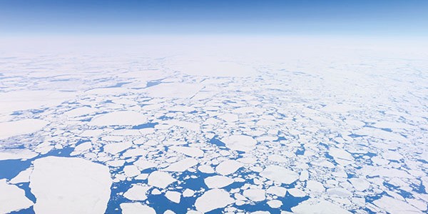
Global climate change is in the news a lot these days, and while it’s clear that polar ice is melting and sea levels are rising, what’s less clear is exactly how quickly, what is causing it, and by extension what we can do about it. Glaciologist Dr. Jason Box and his team from the Geological Survey of Denmark and Greenland’s Dark Snow Project are using rotordrones to help answer some of those questions.
Dr. Box and his team rely on a pair of drones — Isis quadcopters from 3D Robotics (as well as a conventional winged RC drone)— equipped with digital cameras fitted with special filters to photograph and video the reflectivity of the ice sheet in Greenland. The images are then run through spectrographic analysis to determine what substances are collecting on the ice surface. By using the drones, they are bridging the gap between satellite data and boots-on-the-ground sample gathering, saving valuable time and financial resources.
Dr. Box is quickly becoming an experienced pilot and is very enthusiastic about how the drones have advanced the data collection process for Dark Snow. It has been so successful that he and his team hope to raise funds to expand their fleet to include a larger, 1m+ diameter drone that can carry an on-board spectrometer and other instruments. They are also exploring the feasibility of gas power, and he even imagines a drone capable of landing and collecting physical samples from locations inaccessible by foot!
Operating in Dead Zones
With the ongoing studies and test flight of multirotor craft, there are two basic ways these quick-to-deploy aerial workers can help fight forest fires. Since the direction of burns can quickly change, drones can provide a real-time observation of the conditions. This information (video imagery) can be relayed to firefighters on the ground by the drone operator. The other way drones can help is by improving communications.
Firefighters often use laptops, tablets, and iPhones to get updates about changing conditions. Oftentimes, in remote areas these personal devices can’t operate properly in cellular dead zones where Internet service is weak or unavailable. These harsh conditions are common as wildfires are often in difficult terrain and wooded areas where firefighters lose signal. Firefighters often have to travel away from their firefighting duties to reach higher ground to establish proper Internet connections. Rotordrones are ideally suited for use in these areas and could hover at a high altitude over dead zones, to capture and relay otherwise sketchy Internet signals.
With the provided cellular coverage, critical information can then be quickly sent to other firefighters and other first responders so they can compute risk assessments for fire travel rates and coverage and whether the need is present for areas to be evacuated.
 Above: Photo courtesy of african-parks.org
HORTON HEARS A ROTORDRONE?
South African elephants may not appreciate the sound of a multirotor buzzing overhead, but that’s the point: by moving away from the annoying aircraft they are also moving away from the poachers who would slaughter them for their ivory or human conflict where they could get caught in the crossfire. Conservation group Seiya Limited’s Marc Goss says, “I’m assuming that they think it’s a swarm of bees,” which he uses to full advantage to deter the pachyderms from high-risk zones. The manager of Seiya’s Mara Elephant Project, Goss would like to expand his fleet of drones and add a release mechanism to disperse capsaicin, the active ingredient in chili powder, as an added deterrent.
 Above: The CalUSA Monarch multirotor is designed to perform various surveys from the air. The camera (located in the crash protection camber on the bottom) can be changed to perform different jobs. This one has an infrared camera mounted on it for crop surveying. The data acquired from one aerial pass will give the farmer a variety of information that he or she can use to determine the wellness of his or her plants.
Improving our ecological footprint
The use of rotordrones is not just confined to hazardous duty. The agriculture industry too can benefit. With various infrared camera equipment, the condition of crops spread over large parcels of land can be evaluated by rotordrones. In areas where the use of water resources are critical, the hovering drones can measure the heat of the ground and plants to give the crop owners an eye on how well their irrigation systems are working, and whether various crop areas need more or less water. The same process can also help minimize the amount of chemical fertilizer being used and helps crop farmers to be more efficient in bringing their crops to market. From corn and wheat fields, and small community gardening plots to grapes in hillside vineyards, rotordrones can make a huge difference in improving our ecological footprints everywhere.
Idaho State University’s Department of Geosciences is leading an experimental project to use rotordrones to aid in the early detection of potato crop threats. Donna Delparte, an assistant professor, is directing a project which is funded by a U.S. Department of Agriculture grant, which will use multirotor craft to do potato crop surveys at farms in southeast and northern Idaho. Advanced GPS sensors allow precise mapping of the crops to form photo mosaics using a multispectral camera. Delparte commented, “The multispectral camera allows us to understand the health of the crop by viewing it beyond what we can see in the visible part of the spectrum by using infrared.” By using their multi-copter to collect weekly multispectral data from potato crops, they can then compare that data with scans they collect from greenhouse plants that have been exposed to pathogens and pests commonly seen in the fields. If a sick plant in the greenhouse is known to show a spectral scan that indicates some disease or virus, its spectral scan can be compared with the field data. If there is a match, a sample from the field potatoes can be taken to see if they have the same sickness or problem as the plant in the greenhouse. Deploying such a precise survey technique in a much larger scale would be of great benefit.
 Above: Donna Delparte, PhD., Assistant Professor, at Idaho State University’s Department of Geosciences, and graduate student Mike Griffel, kneel next to one of the flying drones they will use for potato crop surveys at farms in southeast and northern Idaho. (Photo courtesy of idahostatejournal.com)
Final thoughts
Without a doubt, there is a tremendous amount of good that multirotor craft and rotordrones can contribute to society. There are universities and organizations across the country and around the world that are funding projects to develop the skills needed to drive this new technology forward. New tasks and missions are being investigated and implemented that are ideally suited for rotordrones. Much of this groundwork and development is being based on individual use. It’s the regular folks, those who enjoy the freedom and unique bird’s-eye view of the world provided by multirotor craft, that are guiding the positive image of rotordrones. With some help and educated views, they can help make the world a better place.


