

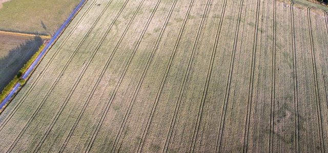
Sometimes an aerial view reveals something that is impossible to see from the ground, and that’s exactly what happened when photographer and author Anthony Murphy flew over the Brú na Bóinne archaeological landscape, a Unesco World Heritage Site about 30 miles north of Dublin. Murphy suspected that a recent drought might reveal signs of a 5,000-year-old man-made enclosure thought to serve as a gathering place that had once been there.
“We knew fairly quickly that this was something that hadn’t been seen before, and I think we both knew it was something very special,” Mr. Murphy, who runs the Mythical Ireland website, said in an interview.
He and a friend saw a series of discolorations in the farmland, caused by differences in soil, spread about 150 meters wide in perfect circles. Murphy had flown the drone over the same field many times before and never saw a hint of what was now perfectly clear, he said.
MacDonagh, chief archaeologist for Ireland’s National Monuments Service, called it a “once-in-a-lifetime” find that would “add greatly to our knowledge of this magical archaeological landscape.” The pattern was about 150 meters wide, big enough to hold a few thousand people.


Yeah. This is amazing archaeological find. It has been the warmest and driest summer in Ireland in 42 years. This is what they archaeologists said about how the dry summer showed up the henge.
He said the bit of moisture left in the soil “lodges in the archaeological features a little bit more than it does in the surrounding soil and the crop that is growing out of the soil is greener in the archaeological features and drier outside of them”.
So when you get an extra dry summer, it’s time to get out with the drone.
It is a massive find.