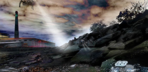
Combining aerial and ground navigation technology, multi-rotor craft are now being used to deploy spider like robots to map and mark hazardous and polluted sights for future reclamation. The rotordrones first evaluate and map the overall location and then setup zones for further investigation. Once these areas are defined, the multi-rotors land and deploy the autonomous ground navigating terra spiders.

Check out this interesting video explaining the ongoing development of this important field of data and information acquiring technology.
The ongoing project was conceived by students in the Architecture program at the California College of the Arts; Manali Chitre (MAAD), Anh Vu (BArch), and Mallory Van Ness (MArch). The Creative Architecture Machines studio course (Fall 2014) was taught by Jason Kelly Johnson and Michael Shiloh. For more class information CCA. got to: http://digitalcraft.cca.edu/