
“This is a crevasse minefield!” yelled Louise. In flat light I was skiing in front, trying to pick the safest way forward. Bumps of blue glacier ice were all around me. My ski tails would settle, leaving behind holes of blackness. Louise moved left to avoid one of my holes. Dave also stepped left into untracked snow. A yell from Dave warned us that he was falling into a crevasse. Louise and I threw ourselves to the snow, bracing for the jerk on the rope. I looked over my shoulder to see Dave windmilling his ski poles but still visible—then he was out of sight, with just the baskets poking out of the crevasse. Then, in horror, I saw the baskets disappear and the 150-pound sled slowly get sucked into the crevasse on top of him. I called back to Dave. No answer. Now the weight, equivalent to two bodies, was pulling on Louise.
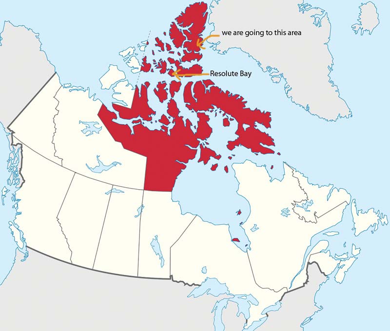
The red area is the Nunavut Territory, Canada. Ellesmere Island is the large red northernmost island in red.
Six days earlier, in late May, our three-person team of Dave Critchley (Chair of Biological Sciences, School of Applied Sciences, Northern Alberta Institute of Technology), Louise Jarry and I had been heading by chartered Twin Otter ski plane from Resolute Bay at Cornwallis Island in Nunavut, Canada to the Prince of Wales Icefield on Canada’s Ellesmere Island’s southeast coast. Winter cold had broken about a week before, giving us weather that was 20 degrees Fahrenheit, which was warmer than the norm. Our starting temperatures were more like what was expected at the end of a month-long Arctic ski tour. The two-plus hour plane flight treated us to some amazing views: jagged coastal cliffs of Devon Island’s Colin Archer Peninsula, followed by the inky blue open waters of Hell Gate Polynya, and then the frosting top of Sydkap Ice Cap, where we had skied across two years before.
Our expedition, Ivory Gulls and Nunataks—Ellesmere 2019, would ski through a portion of the Prince of Wales Icefield checking for activity at ivory gull nesting sites last surveyed in 2009. The word nunatak is from the Greenlandic Inuit, meaning rock outcrops or peaks surrounded by glaciers. The population of the ivory gull in Northern Canada has dramatically declined in the last several decades, and many nesting colony sites farther south, in the Manson Icefield, had already been abandoned by 2009. We decided to focus our survey efforts at the sites that last supported nesting birds. All previous nesting surveys had been done by helicopter. We would ski site to site and use a spotting scope and drone to check for birds and count them.
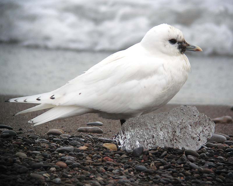
Our expedition was in search of nesting sites of Ivory Gulls.
During our expedition planning, we corresponded with numerous High Arctic researchers and videographers and asked them about their drone flying experiences and equipment recommendations. Alarmingly, everyone who had attempted drone flights north of 70 degrees latitude had horror stories. Some common themes emerged: out-of-control drones spiraling around pilots, or flyaway drones that were never seen again. These issues were often with early generation DJI Phantoms.
According to the experienced operators, the root of these problem flights revolved around lack of strong GPS signal and compass errors. The phenomenon is nicknamed the “toilet bowl effect” for the swirling drone motion as your dollars are flushed away. My experience with GPS signals in the High Arctic has been completely different, at least from a ground navigation point of view. For example, there are always more and stronger satellite signals in the North compared to the Canadian Rockies.
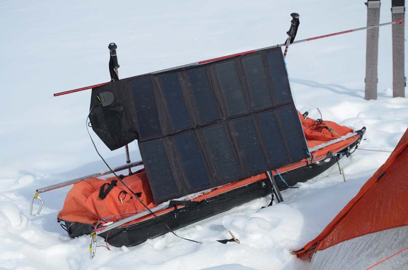
The ALLPOWERS 80-watt folding panel charging away during a snow storm.
THE GEAR
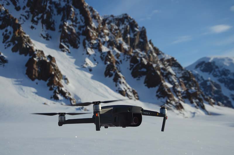
We decided to bring two DJI Mavic 2s, a Zoom and a Pro model. Going that far north with only one drone seemed too risky. If one crashed, then at least we could use the same batteries in the second. A local DJI retailer, MultirotorHeli of Calgary, Alberta, did not think we would have problems flying up North—easy for him to say.
The Mavic 2 Pro/Zoom user’s manual has a number of statements that certainly did not boost our confidence; “The Mavic 2 cannot use GPS within polar regions. Use the Downward Vision System (DVS) when flying in such locations.” OK, we read up on DVS in the manual, and again, the news was not rosy: “The DVS may NOT function properly when the aircraft is flying over water or snow-covered areas.” Our entire trip would be on glaciers that were completely snow covered. The manual further stated, “Operate the aircraft cautiously when in any of the following situations: flying over monochrome surfaces (e.g., pure white), highly reflective surfaces, surfaces that strongly reflect or absorb infrared waves, or surfaces without clear patterns or textures.” Just about all of those surface descriptors equal a snowy glacier.
Along the way, we were given advice that flying in attitude mode (ATTI) would circumvent the need for compass or GPS inputs. Mavic 2 does not have a mode switch like the Phantom 4 that allows it to shift into ATTI. In consulting user groups, such as mavicpilots.com, it seemed that sport or tripod mode could be remapped using DJI Assistant 1.1.2 to become ATTI (in developer tools). Despite numerous attempts to follow instructions given by followers of the user group, the mapping protocol would not work for us. We even tried covering the aircraft top in foil in the hope that we could block GPS signals and force it into ATTI, but had no luck.
We prepared ourselves for the scenario that our drones would be totally useless, like paperweights being dragged around behind us for a month.
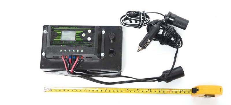
The 12-volt storage battery is inside the box with a voltage regulator on the outside. It weighs 2 kg.
BITTER COLD
The next major hurdle was cold weather operation. During trials in subzero temperatures in Alberta we quickly discovered that our phones were the weakest link. Their thinness and small batteries made for quick heat loss and shutdown. On our first or second flights ever, we learned that if a phone dies after takeoff, you can still control and operate the drone using line of sight along with the controller LCD display. An old, weak cell phone battery is worth replacing for cold weather flying. We bought reusable gel heat packs and built a tablet-sized plywood holder to sandwich the phone and heat pack, and used a PGYTECH Sunshade.
Taking off from the Wykeham Glacier.
A critical selling point for us with the Mavic 2 is the fact that the Mavic Enterprise self-heating batteries can be used on the Pro/Zoom models as well. Used on a non-Enterprise model, the self-heating batteries can only be used by manually starting the heating function. Luckily, we had five batteries between the two drones, since two of the Enterprise batteries developed bent contacts after only one use, which prevented us from using them again. (The drone and charger contacts were in perfect shape, so how the recessed battery contacts were bent is still a mystery.)
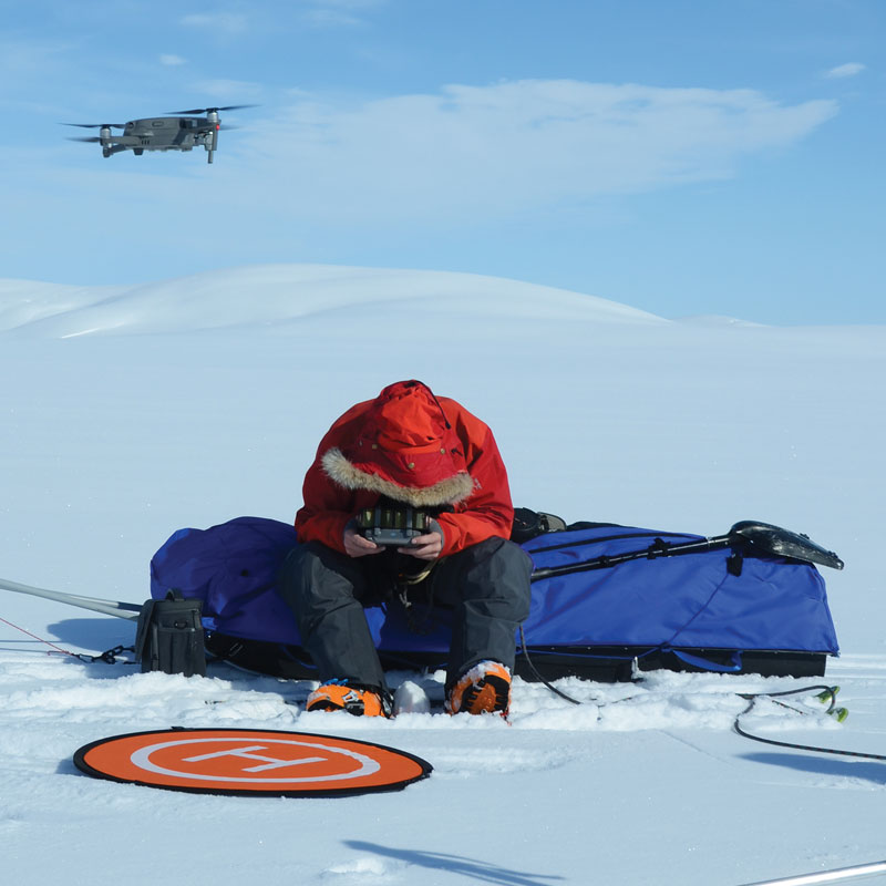
One final showstopping logistic to be worked out was how to reliably charge drone batteries and the controllers. Using our experience from previous Arctic ski trips, we knew that a well-tested system of a small solar panel with storage battery could charge satellite phones, DSLR, InReach, and cell phone batteries. The DJI Mavic2 intelligent batteries proved to be much trickier. First, they are higher voltage and amperage than any previously used battery products. Second, the acceptable charging range using the DJI 12-volt car charger is very narrow.
A PGY Tech sun shade was very useful for strong low angle sun.
Dave sought advice from his school’s Alternative Energy Technology program. They suggested we use an ALLPOWERS folding 80-watt solar panel (1.8 kg, 110 x 60 cm open; 35 x 19 x 9.5 cm folded). With 24-hour sun during our expedition, batteries could be charging all night while we slept, or we could open out the solar panel on a sled as we pulled it by day. Field testing revealed the DJI intelligent battery charges in a very narrow range. If the sun angle and or intensity changes too high or too low, the charger shuts off. The only way to practically overcome that charger sensitivity was to place a storage battery between the solar panel and the 12-volt auto charger. The panel charges the storage battery in an unregulated way, as sun angle and cloud density change all day and night. Then, using a regulator attached to the storage battery (2 kg total weight, with 2.9 Ah lead acid), we could output precise voltage to the 12-volt auto charger and the intelligent battery.
THE JOURNEY BEGINS
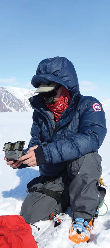
Upon arrival in Resolute Bay, Nunavut Territory, Canada (latitude 74 degrees North), we conducted several brief flights. If things went sideways here, there would be little need to take our paperweights on a ski tour for a month. The DJI user manual states to calibrate the compass if flying at a location farther than 50 kilometers away from the location the drone was last flown. Working by the philosophy, “If it ain’t broke, don’t fix it,” we had not calibrated them in southern Canada, so these two drones had a factory calibration in China, which was 8,000 kilometers away and 42 degrees of latitude change north. Nevertheless, our test flight performance was flawless. The Mavic 2s operated perfectly and we had a green light for operating farther north.
After several days of waiting for suitable flying weather, we made our two-plus hour charter flight. The remoteness of our trip sank in as we flew. During the entire flight we never once crossed a road or passed over a village or permanent habitation. Our intended ski plane landing site was riddled with crevasses, so the pilots nixed the area. Our alternate spot was 12 kilometers away in a gentle bowl of powder snow. Landing uphill in powder, it didn’t take much distance to stop the plane.
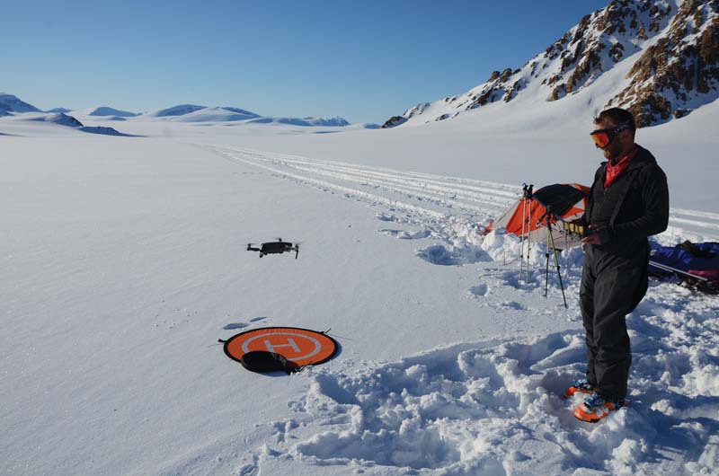
Over the next week, we skied our way across a major unnamed glacier. During the summer, the meltwater flowing on the surface of the glaciers carve canyons into the ice, creating whitewater torrents that are impossible to cross. Some in this area are 50 kilometers long! For us, during spring, the canyons are still significant barriers. They can be 20 to 30 meters across and 10 to 15 meters deep, with overhanging snow drifts along their lips. As we skied up to our first canyon the question was whether to turn left or right to find a snow bridge, or to ramp in and out. Although the drones were brought for seabird detection, we wasted no time launching them for recon missions to help us know which way to cross the canyons. Many hours were quickly saved by knowing the correct path to ski across the canyons.
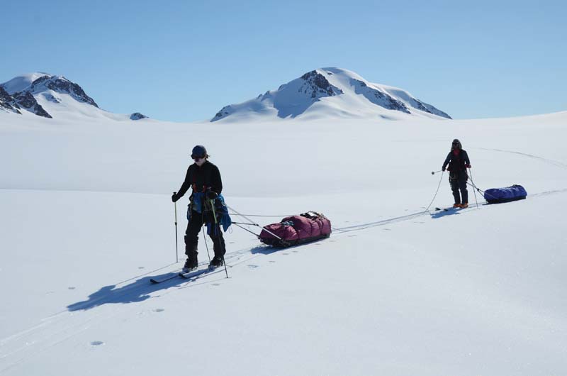
Roped up glacier travel, above left skier (Louise) near the pass is where we were dropped off by the ski plane.
Crevasse icefall on the upper south branch of the Trinity Glacier. This terrain is way too dangerous to attempt pulling a sled.
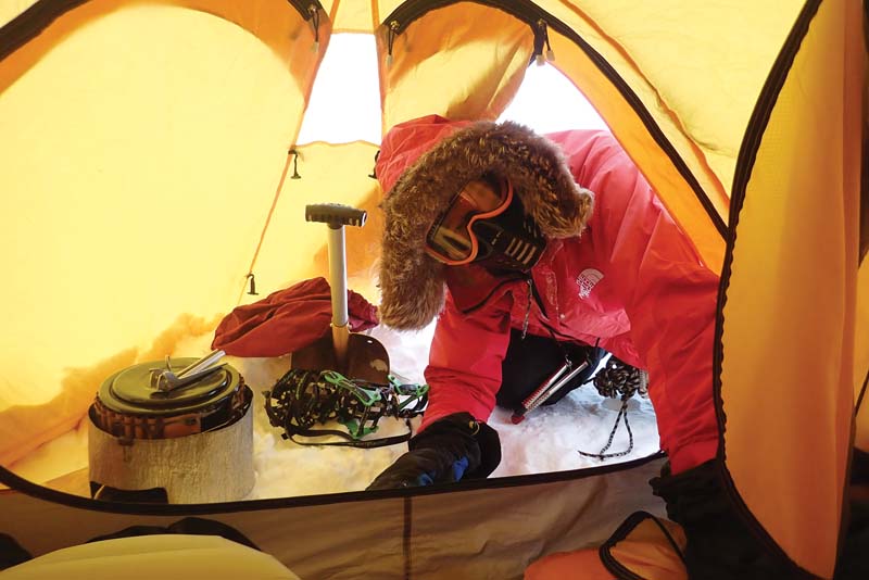
Goggles with facemask attached to prevent frostbite from wind chill.
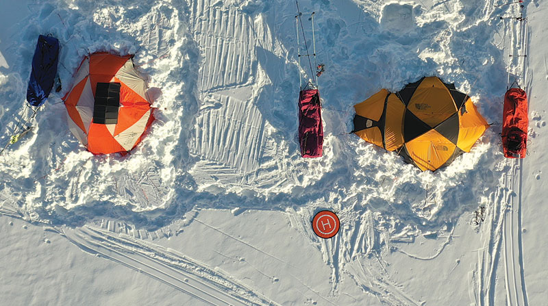
View of typical campsite arrangement, note the solar panel on top of left tent.
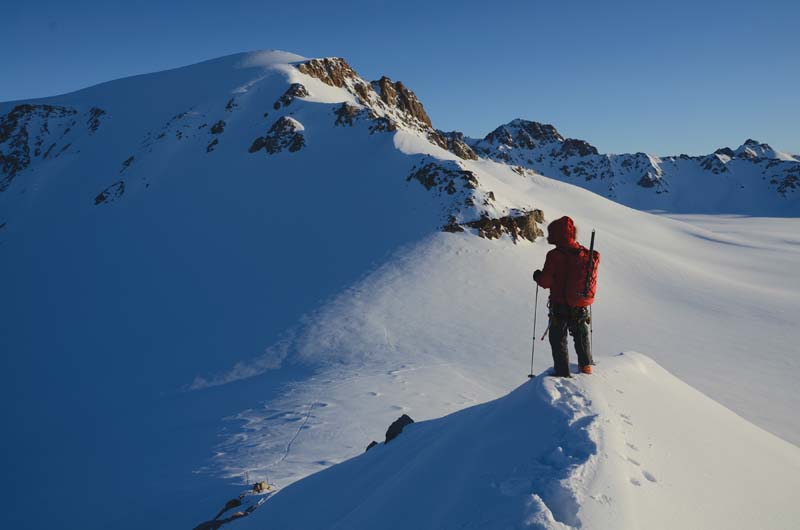
Dave surveying mountain for sign of ivory gull nest site on our first evening.
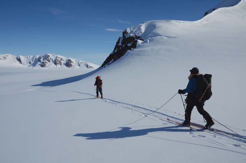
Dave and Louise ski back to camp after climbing our first mountain.
CREVASSE FALL
A week into the ski trip, we descended to Wykeham Glacier. Immediately, we could see the character of this glacier was different than previous ones we had been moving across. Crevasses were evident everywhere, both obvious open cracks as well as slight shallow depressions, indicating sagging snow bridges over blackness. Crevasses form when glacial ice cannot bend more, resulting in breaks that extend down tens of meters or more. Think of it like a cold Mars or Snickers candy bar: At first you can bend the bar and the layer of chocolate on top stays intact, but at a certain point the chocolate coating cracks open to expose the inner layers. If all crevasses stayed open, it would be harder to accidentally fall into one, but drifting snow and ice closures continually cover the slots and form hidden trap doors that might collapse with the weight of skis or boots.
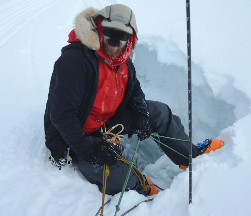
Dave was rescued from the crevasse unharmed, although he just barely dodged the 150-pound sled landing on top of him. Ice screws, rope, pulley work, and a couple hours of sweat were needed to get him and the gear out of the hole. The ALLPOWERS solar panel had been strapped to the top of the sled that day. Hauling the loaded sled out of the crevasse was the hardest work. There was no way to pull it out on its bottom-sliding surface; it came out upside-down over the ice on the solar panel. We fully expected the solar panel to be trashed, and therefore there would be no more drone flights once batteries were exhausted. However, despite this very rough treatment, the solar panel was still working!
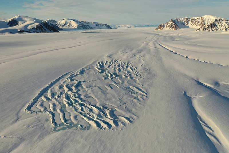
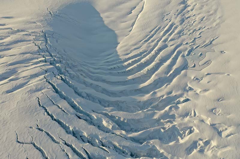
Drone view looking down the Wykeham Glacier, camp near bottom right corner, meltwater canyons are the long furrows.
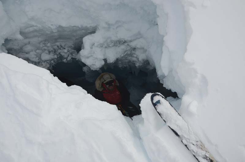
Dave looking out of the crevasse he fell into and happy to be out of his hole.
First drone flight on Ellesmere Island. Next to Dave are the ski tracks where the plane landed and took off.
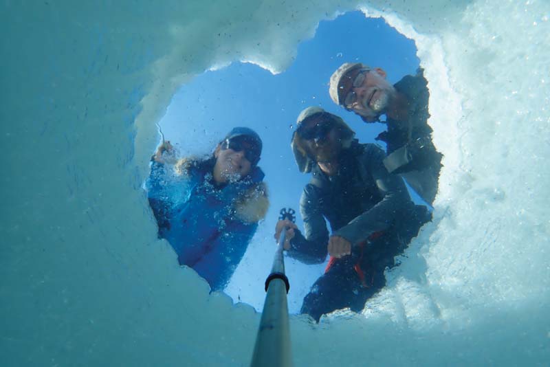
Selfie using Olympus TG5 waterproof camera duct taped to ski pole looking up a seal hole.
Using the parka hood helps create shade in bright conditions.
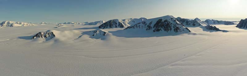
Drone view over southern branch of the Trinity Glacier.
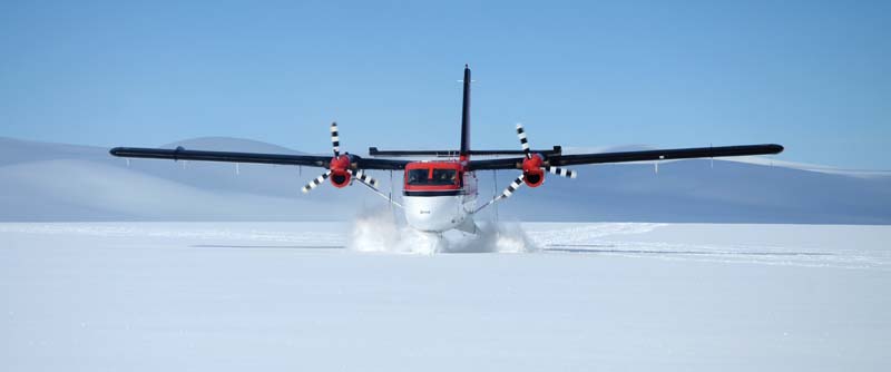
Pilot Kenn Borek’s Twin Otter on skis taxies up the glacier dome to pick up our team.
HEADING HOME
The crevasse fall was a serious wakeup call to us: we needed to very carefully select the safest route on the glacier to avoid as many of the crevasses as possible. We developed a routine. After setting up camp and finishing supper, we’d launch several drone flights to scout the next day’s potential routes. Flights to four previously documented ivory gull nesting sites did not find any activity. Our drone recon missions revealed a direct path to additional sites two days away; they were peppered with hundreds of visible crevasses. Never mind the many more hidden ones. A one-week detour west across and over a gentle icecap was the only way forward.
By the beginning of June, our nearly flawless weather began to break down. We spent three days in camp playing cribbage while 25 centimeters of fresh snow buried all signs of previous sagging bridges. An InReach forecast predicted June 6 would be the only clear day for the next five to seven days. We had to schedule that day for a ski plane pickup or risk missing our scheduled commercial flights south.
The Twin Otter ski-equipped plane circled a couple of times, then descended into the glacial basin to our north, out of sight. Silence followed. After what seemed an eternity we heard the engines revving, then silence, then more revving. Just as we were about ready to launch a drone to investigate, a shark fin appeared from down slope. The tail rudder materialized as the plane climbed its way up the glacier while plowing through deep snow. The plane had landed on the closest sun-lit patch of glacier and had been taxiing many kilometers on its skis, weaving around crevasses to make its way uphill to our camp.
We didn’t see a single ivory gull, so the search for their known nesting sites was a complete bust. However, the utility of small, foldable quadcopters for photography, ski route selection, and terrain hazard assessment in the Arctic proved a huge success. Although the Mavic 2 worked without a hitch for us to latitude 78 degrees, and to 82 degrees North for another pilot in 2019, a cautionary note should be made: There are large ore bodies in the North that will leave compasses spinning. When you’re flying in such an area, all bets are off. Be prepared and able to fly in ATTI mode.
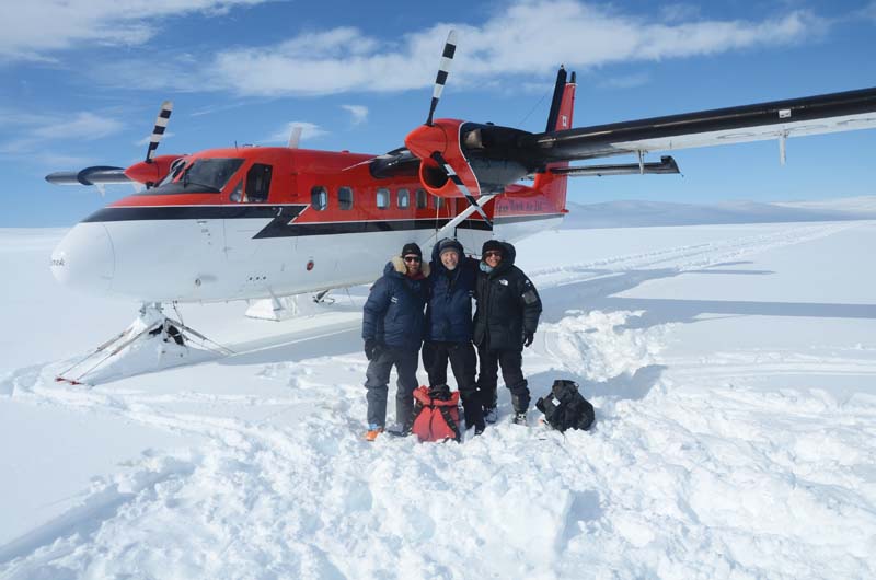
The Ivory Gulls and Nunataks 2019 team, Dave, Greg, and Louise, with the Twin Otter plane.
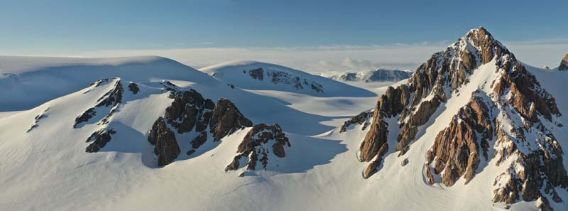
Drone view of an unnamed peak on the left we skied to the top of.
DIY Arctic Phone Holder
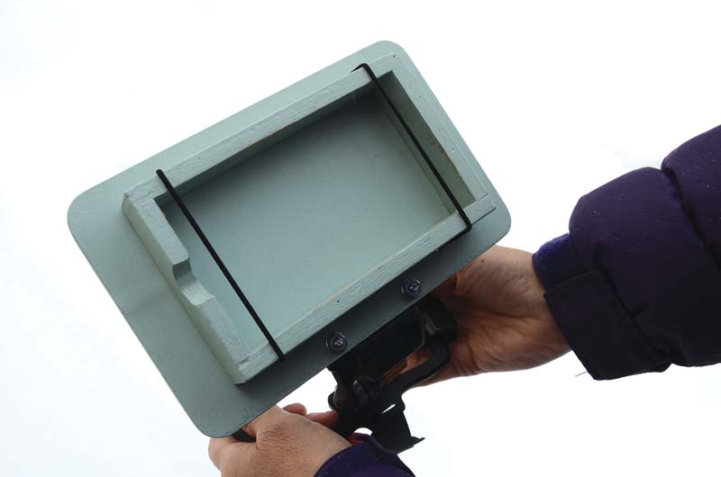
Start with a wood frame with elastic straps.
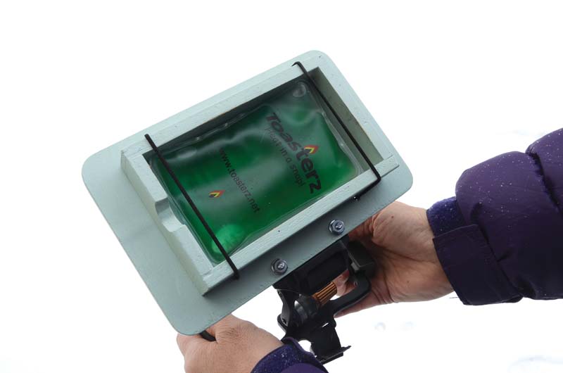
Add a heat pack.
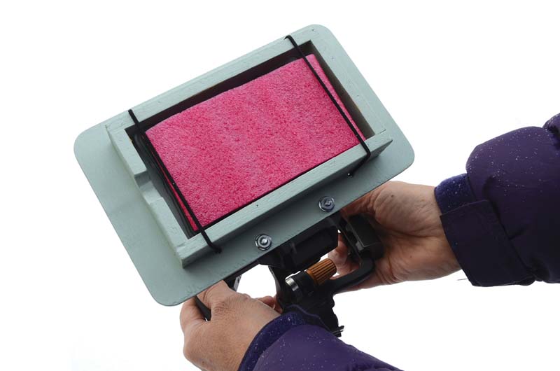
Insert a thin foam protector.
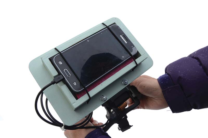
Secure your phone in place.
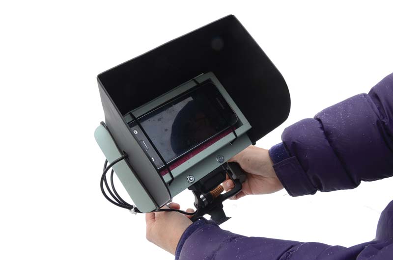
A sunshade makes it easier to see your phone’s display.
7 Tips for Flying in the Cold & Snow
ONE
Read Your aircraft’s users manual. Be familiar with the manufacturer’s specifications with regard to the operating temperature range. This includes range of the controller and batteries. Know the charging temperature range of your batteries. Batteries that are too cold will not charge correctly or may be damaged. Make short test flights in cold weather until you gain understanding of how your aircraft and associated devices handle the cold.
TWO
Keep Batteries Warm. Before use, keep aircraft, controller, and phone and tablet batteries warm. If you are out in the field for hours or all day, keep components with batteries near your body or use a heat source to maintain batteries at room temperature. A fly fisherman’s vest with lots of big pockets can keep items organized under insulation layers. If that’s too bulky or awkward, try an insulated soft-sided lunch cooler bag with hot water in plastic bottles. (I suggest Nalgene brand, which can handle hot to boiling water.) Place those bottles in a sock or mitten when you first start to use them to ensure that a very hot bottle does not directly touch batteries or plastics.
THREE
Keep the Aircraft Cool. To prevent condensation or frost forming on your lens and sensors, don’t move the aircraft back and forth from warm to cold to warm. After the aircraft leaves home, your car, or warming bag, keep it in the cold until your flying is done for the day.
FOUR
Be Gentle with All Equipment. In order to shave weight and cut costs, much of drone equipment is made of plastic. The colder it gets, the more fragile everything becomes. Many components were never designed to be used below freezing. Go slowly and warm parts before flexing or bending.
FIVE
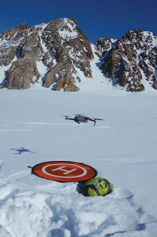
Use a Landing Pad. Collapsible pads are not just for dust and vegetation. Unless you are landing on bare ice, use pads to prevent snow from spraying on the lens, or the aircraft from bellying out in soft snow. Some aircraft use takeoff features to help with precise landing, and a distinct “H” will be much easier to find than acres of featureless white.
SIX
Use Neutral Density Filters. For smooth video display, a frame rate of 24 to 30 per second is common. The shutter speed should generally be twice the frame rate. In bright snow conditions using a camera with a fixed aperture, neutral density filters are an excellent way to slow down the shutter speed and reduce glare. Experiment with different densities before critical shoots and remember that time of day will change the density you need. A range of 4 to 32 (times reduction in light) will cover most situations outside of time-lapse shots.
SEVEN
Shade the Screen. It isn’t fun to squint and barely be able to see anything on the phone or tablet screen on a bright day in a snowscape. There are many devices on the market to help reduce glare and provide shade to your screen. The other options are monitor devices like DJI’s Crystal Sky or Smart Controller that have screen brightness higher than most phones or tablets. The other significant advantage of those devices is the large milliamp battery they use with low operating temperatures that uninsulated phones or tablets can.
By Greg Horne Photos by Greg Horne, Louise Jarry & Dave Critchley